
Some journeys are about the destination. This one is about the road itself, the wind in your face, the curve of the coastline unfolding with every turn, and the freedom to stop wherever the view demands. Here is the definitive motorbike itinerary along Đà Nẵng’s most spectacular coastal roads.
The route at a glance
Total distance: Approximately 45 kilometers
Duration: 4–6 hours (with stops)
Start: Hải Vân Pass (north of Đà Nẵng)
End: Sơn Trà Mountain (Monkey Mountain)
Best time: Early morning (6:00–8:00 AM start) to avoid heat and afternoon clouds
Leg 1: Hải Vân Pass – The Cloud Pass
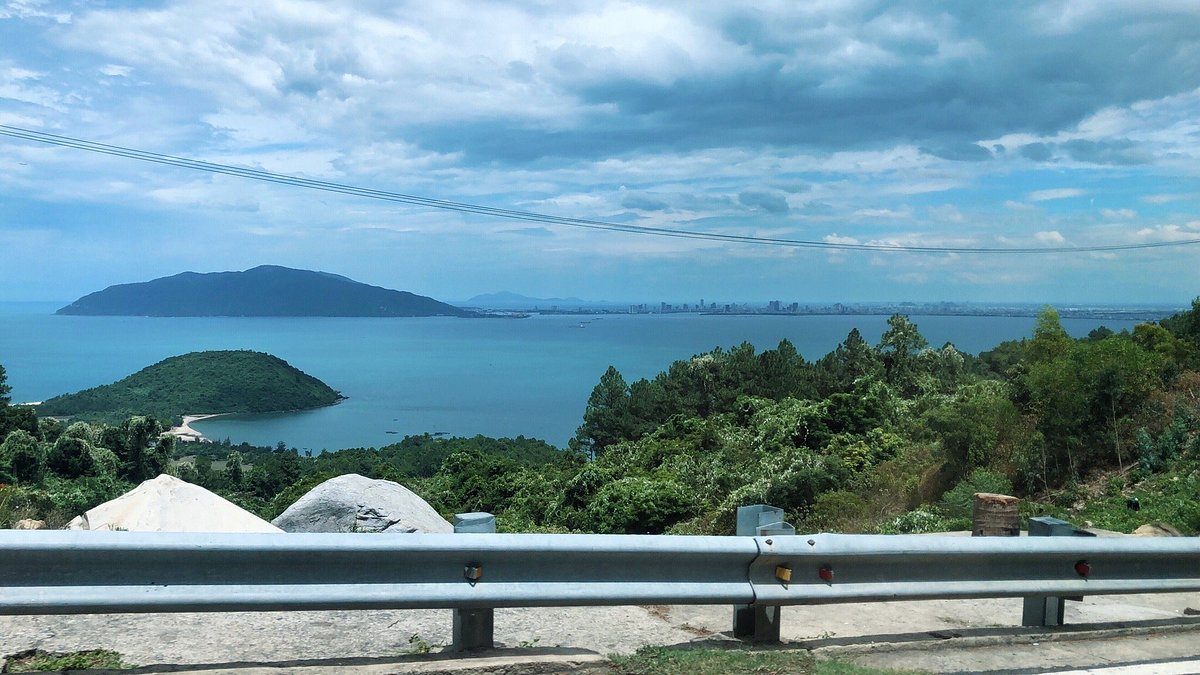
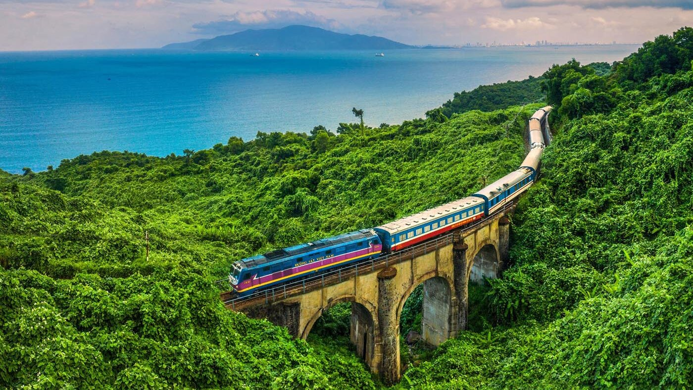
The journey begins at the legendary Hải Vân Pass, the mountain road that has captivated travelers for centuries. Rising 500 meters above the sea, this 21-kilometer stretch of winding asphalt divides Thừa Thiên Huế from Đà Nẵng, offering views that have earned it recognition as one of Vietnam’s most scenic coastal roads.
From the northern approach, the road climbs steadily through switchbacks carved into the mountainside. Each turn reveals a broader sweep of coastline: fishing villages below, the turquoise curve of Lăng Cô Bay, and on clear days, the distant mountains of central Vietnam fading into haze.
Stop at the summit: The Hải Vân Quan (Hải Vân Gate) marks the pass’s highest point. This restored stone fortress once marked the boundary between two kingdoms. Park your motorbike, walk through the archway, and stand where emperors and soldiers once surveyed their domain. The view from the ramparts is the pass’s finest, ocean on both sides, mountains rising behind, and the road snaking below.
Hidden beach stop: Before descending toward Đà Nẵng, watch for an unmarked dirt track on the eastern side of the summit. It leads to a secluded cove where fishing boats shelter. The beach is rocky rather than sandy, but the solitude and sense of discovery reward the detour.
Leg 2: The coastal run to Đà Nẵng
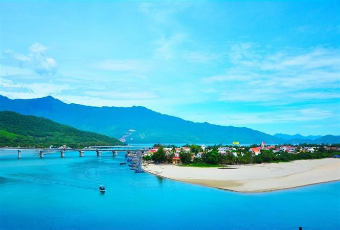
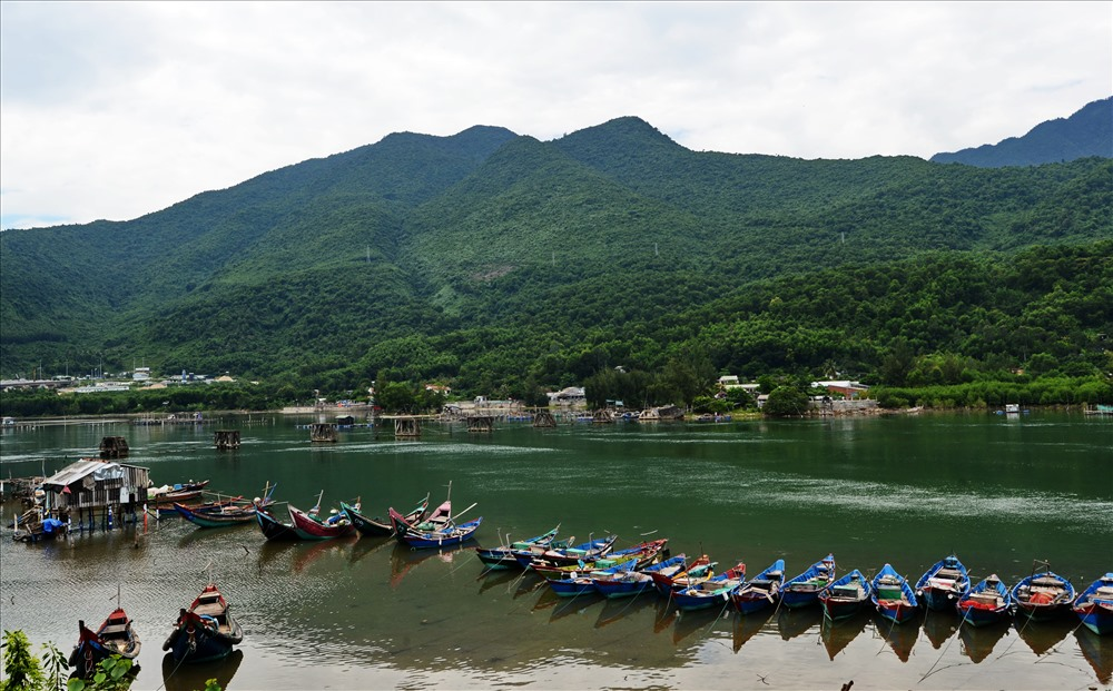
Descending from Hải Vân, the road follows the coastline past fishing villages where boats rest on the sand between voyages. This stretch offers a different beauty, less dramatic than the pass, but intimate and authentic.
Làng Chài (Fishing Village) stop: Pull over at the first village below the pass. Morning light illuminates the boats, and women mend nets on the shore. This is not a tourist stop but a working community. Park respectfully, photograph from a distance, and observe a way of life that has sustained these shores for generations.
Bãi Cát Vàng (Golden Sand Beach): Further south, a curve in the road reveals a sandy stretch often empty even on weekends. The water here is calm, the sand fine, and the view back toward Hải Vân Pass makes this an ideal breakfast stop. A few local vendors sell coffee and bánh mì from makeshift stalls.
Leg 3: Đà Nẵng’s Beachfront
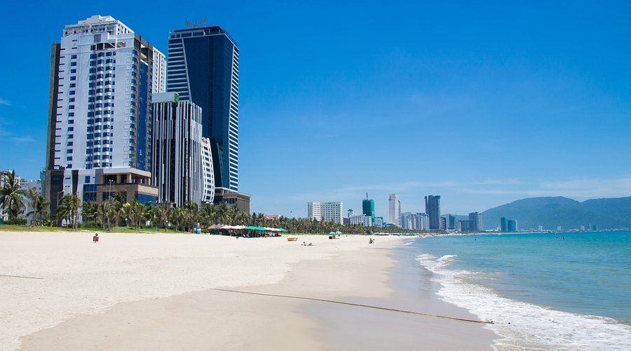
The road straightens as you enter Đà Nẵng, following Võ Nguyên Giáp, the boulevard that traces Mỹ Khê Beach. This section offers a different rhythm: the energy of a city that has embraced its coastline.
Pause at the beach: Pull off anywhere along My Khê to stretch your legs. The water is visible from the road, and multiple access points allow quick stops. For the best view, park near the central lifeguard tower and walk onto the sand. The curve of the bay framed by Sơn Trà Mountain ahead reminds you that the journey is not yet complete.
Coffee stop: Several beachfront cafés cater to riders. Cộng Cà Phê offers elevated views of the coastline. Bikini Bottom is a rider-friendly spot with shade and cold drinks.
Leg 4: Sơn Trà Mountain – The Peninsula Loop
The final leg begins where the city ends. The road into Sơn Trà Mountain rises immediately, trading urban energy for forest silence. This is the route’s most rewarding section, a winding ascent through primary jungle with the ocean always visible through gaps in the canopy.
Bãi Bắc (North Beach): The first major stop sits at the peninsula’s northern base. This sheltered cove offers calm water and a small stretch of sand rarely crowded. The road above provides an elevated view of the cove, one of the route’s finest photo opportunities.
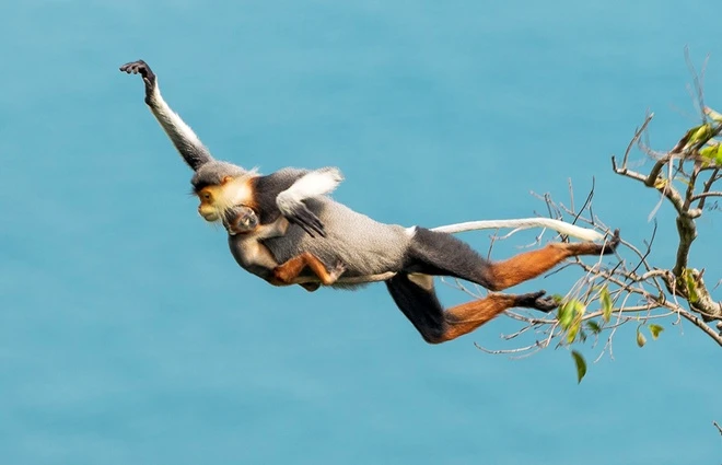
The Summit Road: From Bãi Bắc, the road continues upward toward the radar station. Here, the forest closes in. Langurs occasionally cross the road. Overlooks appear without warning, each offering a new perspective on the coastline below.
Bàn Cờ Peak: The highest accessible point on Sơn Trà delivers the journey’s panoramic reward. Park near the communications tower and walk to the summit’s edge. Below, Đà Nẵng spreads toward the horizon. To the north, Hải Vân Pass traces the mountain’s contours. The South China Sea fills everything else.

Hidden Beaches along the route
Bãi Đá Đen (Black Rock Beach): Accessible via a dirt path from the main Sơn Trà road, this pebble cove offers solitude and clear water. The descent requires caution; the reward is a beach that feels undiscovered.
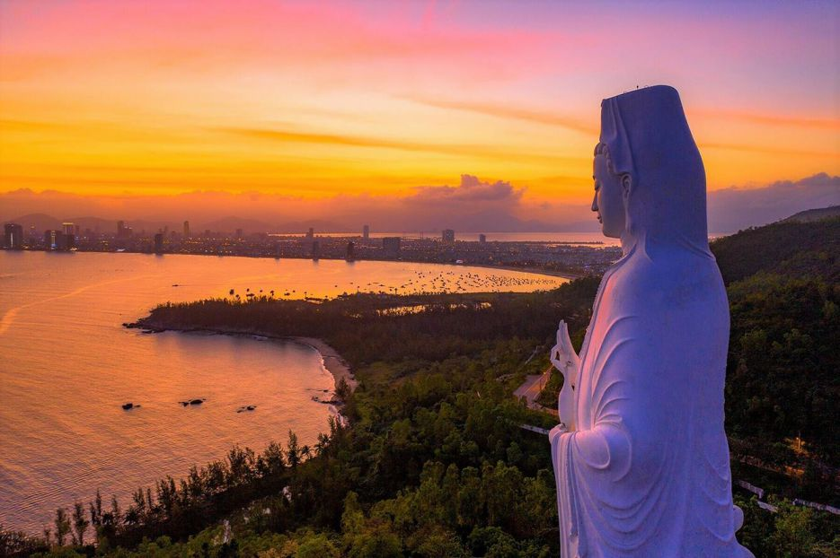
Bãi Bụt (Buddha Beach): Another hidden cove on Sơn Trà’s eastern face. The path is easier than Bãi Đá Đen, and the sand is softer. Early morning visits offer calm water and the possibility of spotting langurs descending to the shore.
Bãi Rạng: On the peninsula’s southern side, this beach sits near the fishing harbor. The water is calm, and local seafood stalls serve the day’s catch. A good stop for lunch before completing the loop.
Practical tips for the ride
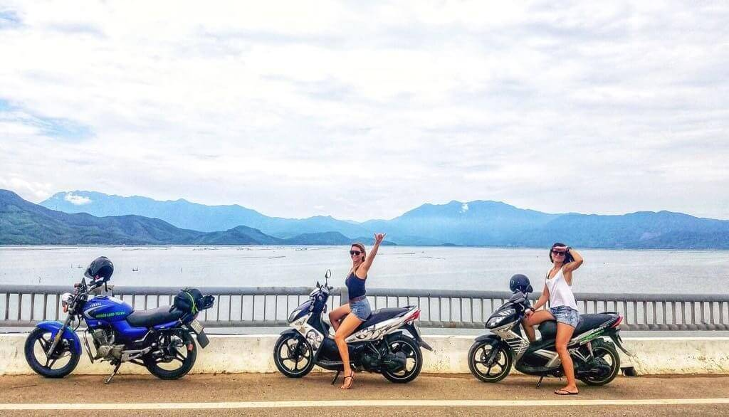
Motorbike rental: Đà Nẵng has numerous rental shops. Expect to pay 100,000–150,000 VND ($4–$6) per day for a semi-automatic. Ensure brakes and tires are in good condition, the mountain roads demand reliability.
Fuel: Fill up before starting. The only fuel stations on the route are in Đà Nẵng proper. A full tank covers the entire itinerary with reserve.
What to wear: Long sleeves and pants protect from both sun and road. A light jacket is essential for the Hải Vân Pass, temperatures drop significantly at the summit. Helmet use is mandatory and non-negotiable.
What to bring: Water (at least 1.5 liters per person), sunscreen, phone with maps downloaded offline, cash for food and fuel, and a camera within easy reach, the best views appear suddenly.
Timing: Start at sunrise (5:00–5:30 AM) to experience Hải Vân Pass in the best light and avoid afternoon clouds that often obscure the summit views. Complete the Sơn Trà loop by mid-afternoon to return before the sun dips behind the mountains.
Safety considerations
Road conditions: Hải Vân Pass is well-paved but has sharp curves and occasional loose gravel. Trucks use this route; pass with care and patience. Sơn Trà’s roads are narrower with blind corners, use your horn at curves and stay to the right.
Weather: Morning fog sometimes obscures the pass. If visibility drops below 50 meters, wait for it to lift, usually by 7:00 AM. Rain makes the roads dangerous; check forecasts and postpone if storms are predicted.
Respect: Both Hải Vân Pass and Sơn Trà Mountain are protected areas. Do not litter. Do not disturb wildlife. The langurs of Sơn Trà are endangered, observe from a distance and never feed them.
This route offers something rare in modern travel: a journey where the road itself is the destination. From the summit of Hải Vân to the hidden coves of Sơn Trà, every kilometer delivers a new perspective, a new discovery, a new reason to pause. Take it slowly. Stop often. And let the coastline reveal itself at its own pace.